Environmental Hazards of Peatland Conversion: Multi-Spectral Remote Sensing Analysis
Satellite-derived multi-spectral indices quantifying hydrological degradation, canopy moisture loss, and drainage canal networks following industrial peatland exploitation across Sumatra and Kalimantan.
THE QUESTION
How severely do artificial drainage canal networks degrade canopy moisture and surface water retention in tropical peat dome ecosystems?
BACKGROUND
Tropical peatlands are massive terrestrial carbon sinks, storing over 50 gigatonnes of carbon in Indonesia alone. When converted for monoculture oil palm or acacia timber estates, the installation of deep drainage canals lowers the water table, triggering irreversible peat oxidation, subsidence, and extreme wildfire susceptibility. This project deployed multi-spectral satellite imagery (Sentinel-2 and Landsat 8) to model moisture dynamics and canal-induced desiccations across 450,000 hectares of peatlands.
APPROACH OVERVIEW
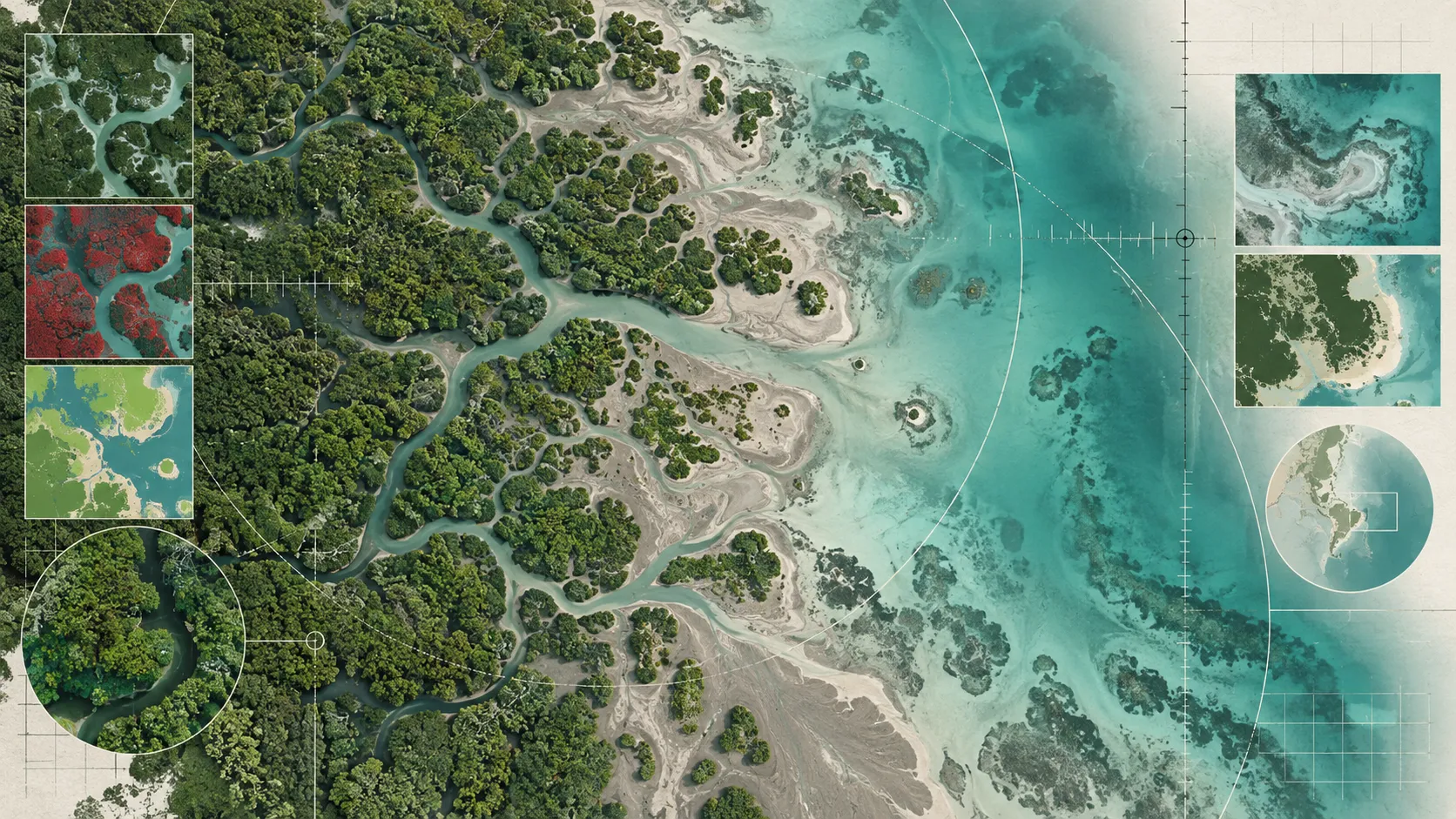
CLOUD-OPTIMIZED SATELLITE COMPOSITING
Cloud-masking and multi-temporal median compositing of Sentinel-2 MSI (Level-2A) and Landsat 8 OLI surface reflectance over major peat hydrological units (KHG).
DRAINAGE CANAL NETWORK VECTORIZATION
High-resolution linear feature extraction and edge-detection filtering to map artificial drainage canals across degraded peat forest concessions.
SPECTRAL MOISTURE INDEX COMPUTATION
Time-series derivation of Normalized Difference Water Index (NDWI), Normalized Difference Moisture Index (NDMI), and Land Surface Temperature (LST).
PROXIMITY DESICCATION MODELING
Spatial buffer distance regression modeling the radial desiccation footprint of canals on adjacent primary and secondary peat swamp canopy health.
VULNERABILITY INDEX SYNTHESIS
Integration into a multi-criteria Peat Hydrological Degradation Index (PHDI) to guide canal-blocking restoration priorities.
METHODS
- •Optical Spectral Indices: Calculation of NDWI (Green - NIR / Green + NIR) and NDMI (NIR - SWIR / NIR + SWIR) at 10–20 m resolution to track seasonal moisture retention.
- •Thermal Radiance Calibration: Processing Landsat 8 Thermal Infrared Sensor (TIRS) band 10 to derive Land Surface Temperature (LST) split-window algorithms.
- •Canal Mapping: Automated linear morphological operations combined with high-resolution PlanetScope visual verification for drainage canal tracing.
- •Distance Decay Profiling: Zonal statistics extracting moisture and temperature gradients at 50 m interval buffers up to 2,000 m perpendicular to drainage canals.
- •Field Peat Groundwater Cross-Validation: Comparison with in situ peat water table (TMA - Tinggi Muka Air) telemetry loggers from national peat restoration monitoring stations.
KEY DATA SNAPSHOT
RESULTS
Multi-spectral remote sensing demonstrated that artificial drainage canals exert a significant desiccation footprint extending up to 650 meters laterally into adjacent peat swamp forest, causing a 38% reduction in canopy moisture index (NDMI) and a 4.2 °C elevation in surface temperature during the dry season.
DISCUSSION
Canal-induced lateral drainage creates chronic edge desiccation, rendering even nominally protected interior peat forests highly combustible during El Niño dry seasons.
Canal blocking interventions showed rapid spectral recovery: re-wetted parcels restored 75% of baseline NDWI moisture within 18 months of dam construction.
Remote sensing of moisture deficits provides a non-invasive, cost-effective alternative to sparse in situ dipwell sensor networks.
LIMITATIONS
- •Dense persistent cloud cover during equatorial wet seasons limits optical satellite observations to narrow seasonal dry windows.
- •Sub-surface peat peat smoldering cannot be directly detected by optical sensors without coincident thermal infrared or synthetic aperture radar (SAR) data.
IMPACT & APPLICATION
DATA & REPRODUCIBILITY
Analytical code and specific target coordinates are currently held under institutional review and confidential protocol.
REFERENCES
- page2011Page, S. E., et al. (2011). Global storage of carbon in tropical peatlands. Global Change Biology, 17(2), 798–818.
- gao1996Gao, B. C. (1996). NDWI—A normalized difference water index for remote sensing of vegetation liquid water from space. Remote Sensing of Environment, 58(3), 257–266.